- Size: 435 square miles of surface water
- Length: 120 miles
- Width: 12 miles at its widest point
- Depth: average depth is 64 feet but the deepest point is between Charlotte, VT and Essex, NY at 400 feet
- Amount of Shoreline: 587 miles
- Islands: 71
- Watershed size: 8,234 square miles
- Surface Elevation: The lake’s average annual water level is 95.5 feet.
- Drinking Water: Lake Champlain is a drinking water source for approximately 200,000 people.
Above the Water
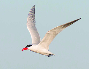 |
| Birds: There are 318 species of birds in Vermont that live on, near, or depend on Lake Champlain. Of particular interest is the Common Tern, as protecting the habitat of this acrobatic flyer was an early success story of the Lake Champlain Land Trust. By working with our partners to conserve important nesting islands and educate the public, Common Tern nesting pairs rose from only 50 counted in 1988 to 275 pairs counted in 2013! The Common Tern now nests on several islands protected by the Lake Champlain Land Trust. |
Below the Water
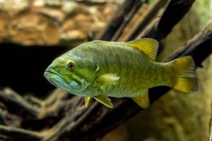 |
| Fish: Lake Champlain has over 90 species of fish and is considered one of the best bass fishing lakes in the Northeast, recently ranked as the sixth best lake in the region by Bassmaster Magazine. We have worked with communities up and down the lake to protect shoreline, wetlands and river corridors that provide critical fish spawning habitat. Check out our Hike and Paddle page for some great fishing destinations, including Mill River Falls in Georgia, VT and Knight Island in North Hero, VT. |
On the Water
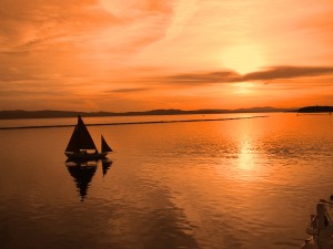 |
| Transportation: Crossing Lake Champlain is a breeze! Drivers, bicyclists, and walkers can cross the grand Champlain Bridge from Addison, VT to Crown Point, NY. In the Champlain Islands region north of Burlington, drivers can follow Route 2 across a mile-long causeway, a small drawbridge in North Hero, and a scenic bridge connecting Alburgh, VT to Rouses Point, NY. In the South, drivers can cross the stunning South Bay Bridge from Whitehall to Dresden, NY. There are also three ferries to get across the wider points; from Charlotte, VT to Essex, NY, from Burlington, VT to Port Kent, NY and from Grand Isle, VT to Plattsburgh, NY. Or you can pick our favorite way and rent a canoe or kayak! |
Hidden in the Water
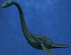 |
| Dinosaurs: Lake Champlain is home to the oldest known fossil reef in the world (450-480 million years old!), and some think that there may still be a dinosaur in the lake. Champ is a mysterious creature, similar to the Loch Ness Monster, that many have claimed to see while enjoying the lake. Whether Champ is a dinosaur, a plesiosaur, a whale, or even exists at all is a mystery, but going on a hunt for Champ on one of our preserved lakeshore properties is a great way to spend an afternoon. |
About the Water
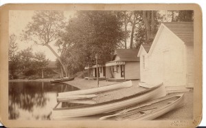 |
| History: Lake Champlain was named in 1609 by Samuel de Champlain, a French explorer. During the Revolutionary War, the lake was an important asset for allowing movement from the colonies to Canada and keeping New England a strong, connected force. It proved to be important in the military again in the War of 1812 for building ships, particularly out of Vergennes. The lake started to become a large tourist and recreation draw around 1945 after World War II. It is now a vital economic engine for the communities that surround it. |
About the Land
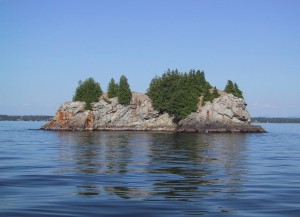 |
| Geography: Lake Champlain is part of two states and one province–Vermont, New York, and Quebec–and two countries–the United States and Canada. The majority of the population in the basin are from the United States, with a ratio of 18:1. Vermont residents make up 72% of the United States population living in the basin. This gives Vermonters a great opportunity to really help protect the lake, but they can’t do it alone! |
About the Sea
 |
|
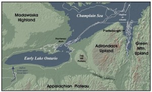
Ice Age: At the peak of the Ice Age, Vermont was covered by glaciers. The retreating ice compressed the rocks and allowed the Atlantic Ocean to create an inlet into what is now New England and Eastern Canada. This inlet is referred to as the Champlain Sea, but was composed of mostly fresh water since it was constantly being fed with water from glacial melt. As the land started to rise again, the sea slowly shrunk forming the Lake Champlain we know today. Some of this information comes from Lake Champlain Basin Program. Featured Image (Top): Brendan Wiltse |

